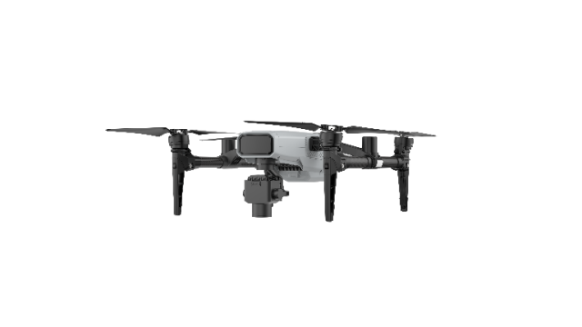
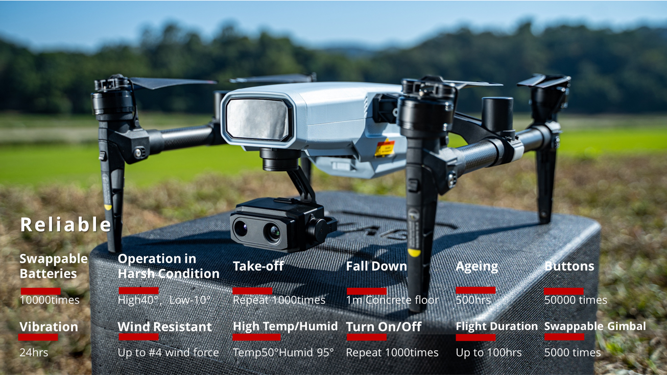
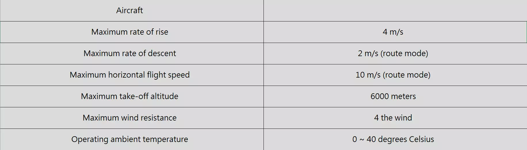
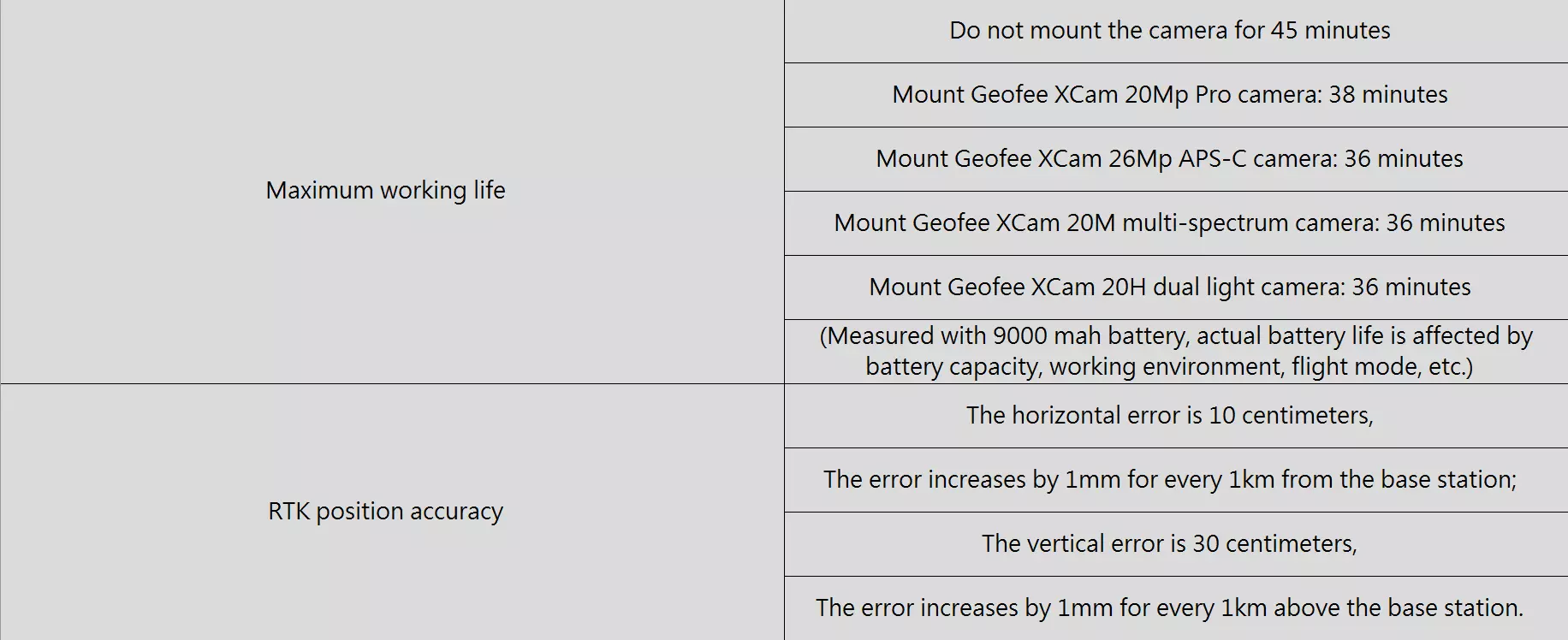
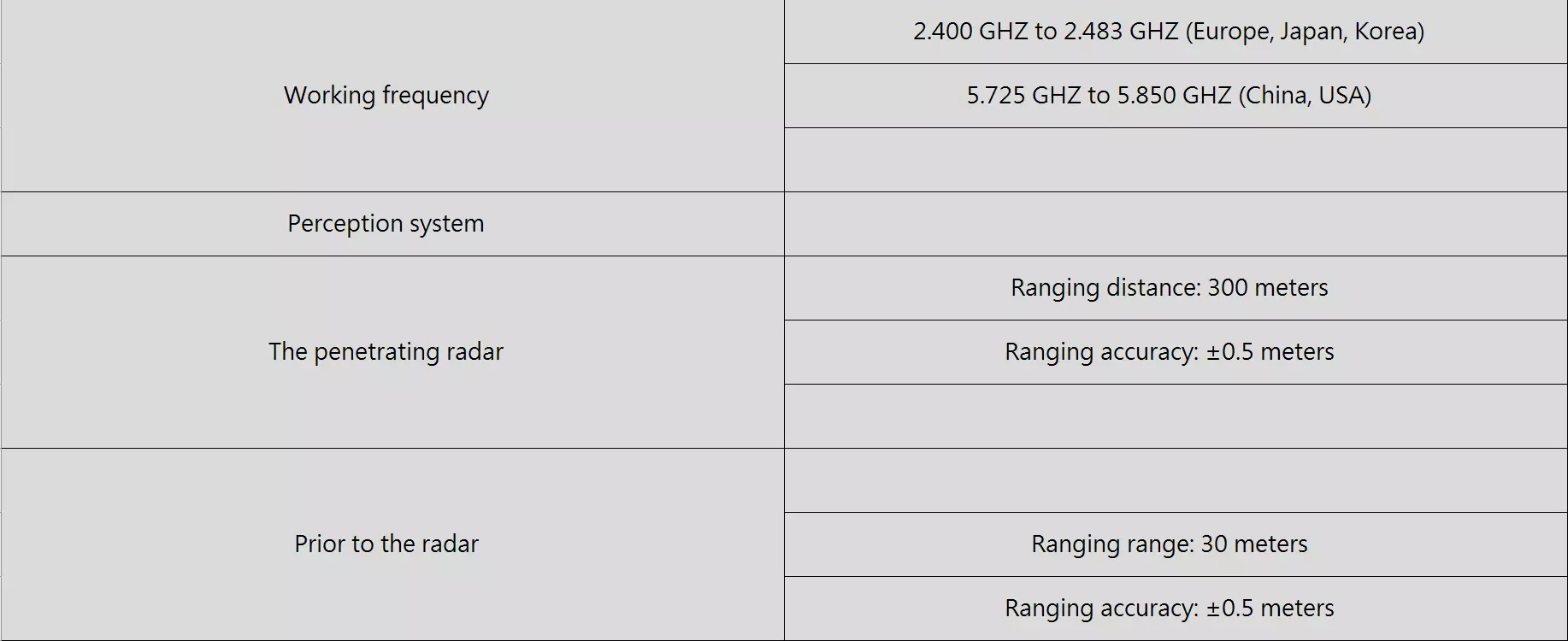
An industrial level UAV, built for multiple tasks in precision-ag mapping.
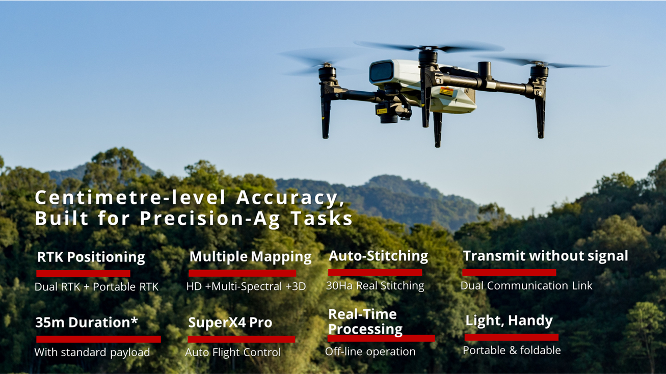
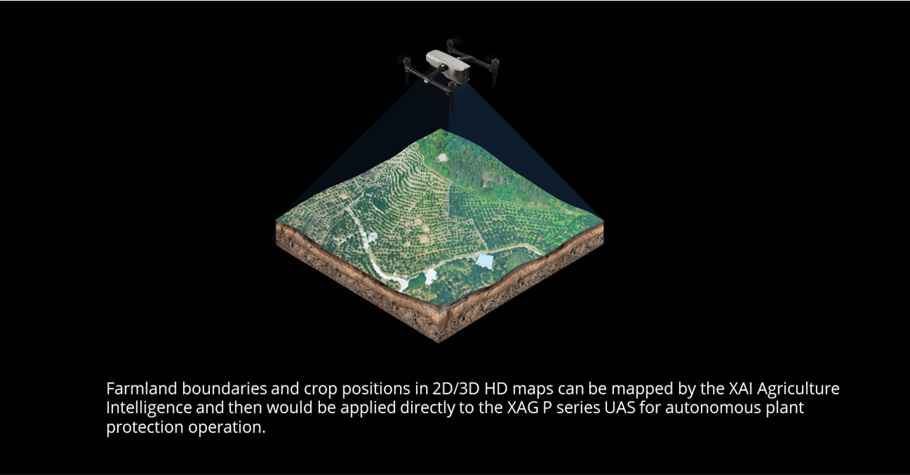
(High definition, multi-spectral mapping, 3D modeling), and informed decision.
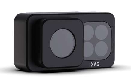
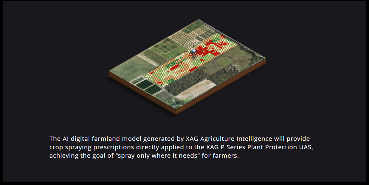
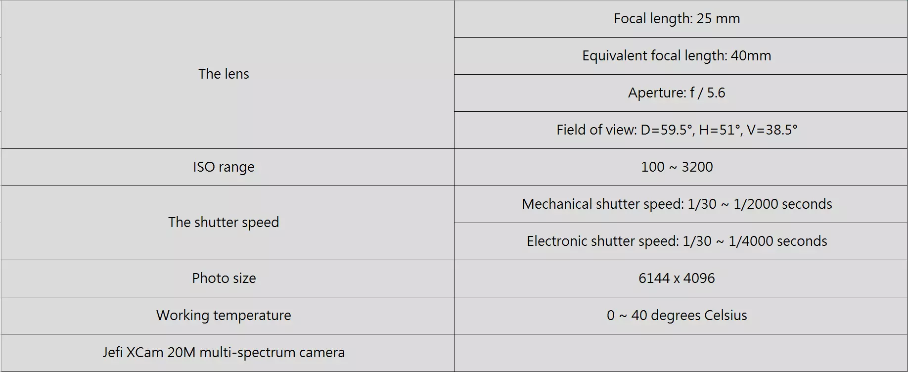
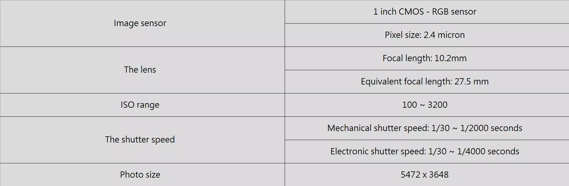
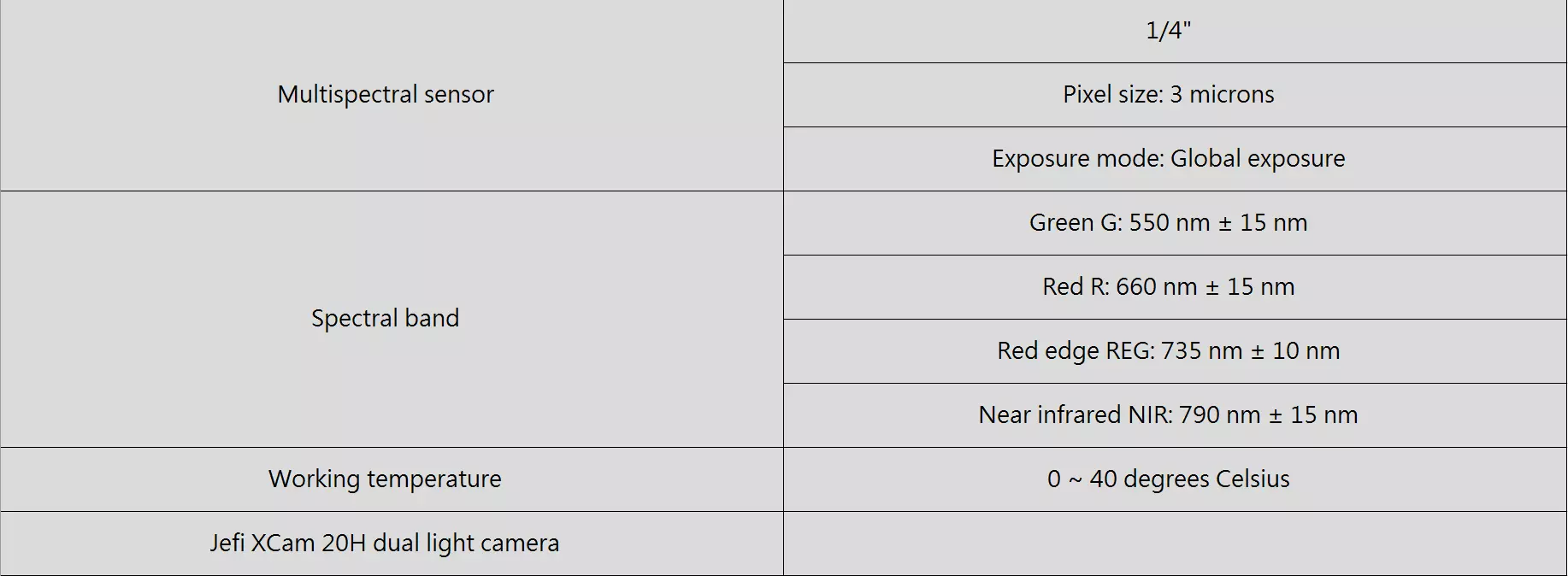
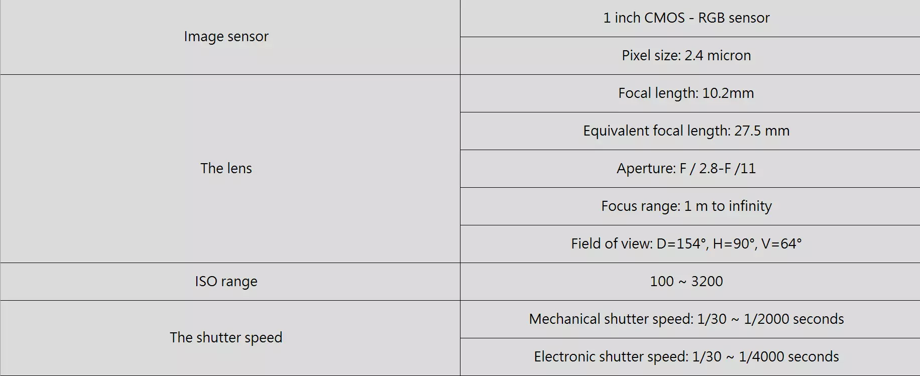
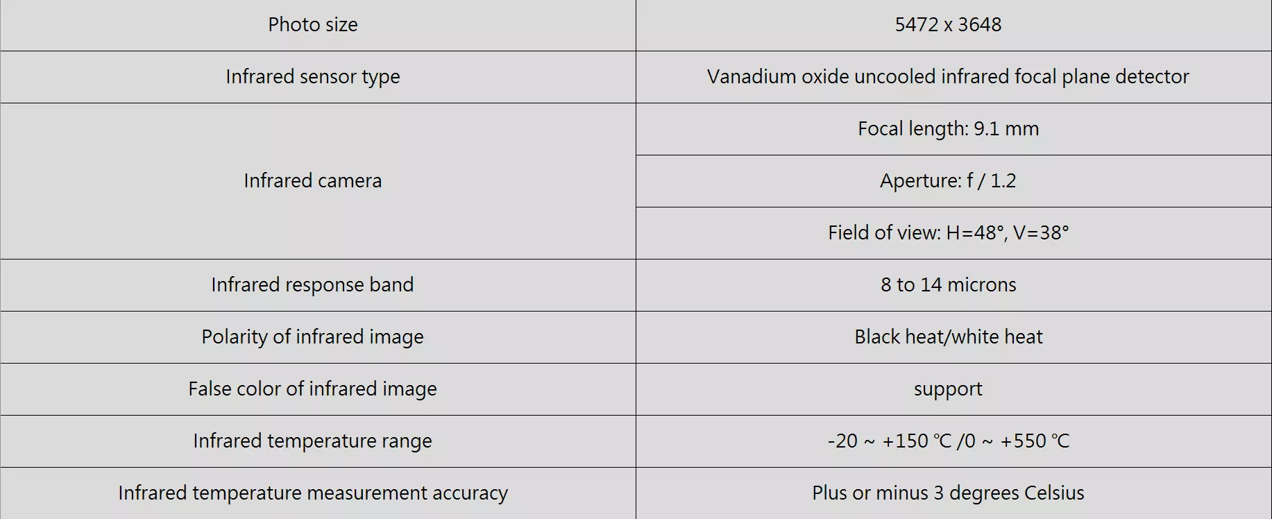
XAG XCam MultiSpectrum Remote Sensing to Facilitate Precise Decision-making
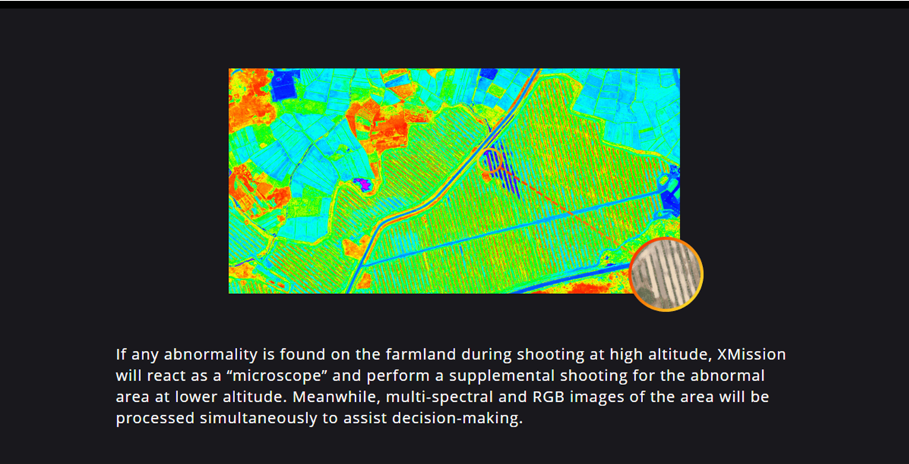
With XCam MultiSpectrum camera, 4-spectrum HD crop images can be captured as well as HD RGB images. The NDVI map aligned in pixel level can facilitate on-site agriculture decision making. The farm prescription map generated by XAI can be applied directly to the XAG P series UAS for autonomous plant protection operation