Summary:
- Drones have revolutionized the agriculture and it i clear that unmanned aerial vehicles will remain an invaluable asset for agricultural operations for many years.
- The agricultural industry is being revolutionized by the use of drones for crop monitoring. Farmers can increase productivity and yield by using advanced sensors and imaging.
- Drones in agriculture have radically changed the way farmers can manage their land, livestock, and crops. Smart farming is on the rise!
- Drones can be used to collect data on the specific needs of individual plants or crops, allowing farmers to apply resources, such as fertilizer or water, more precisely and efficiently.
- Advances in drone technology have allowed for improved livestock monitoring in agricultural settings. Drones provide farmers with a useful tool for surveying both crop and herd operations.
- There is also potential for using drones to apply fertilizer and pesticides with automated precision, further helping farmers achieve maximum performance in all aspects of their operations.
- With drone technology available across Middle East and Africa, agribusinesses will be able to increase overall productivity while decreasing costs associated with traditional monitoring methods – making a positive difference for global food supply.
The use of drones, also known as unmanned aerial vehicles (UAVs), and connected analytics
has great potential to support and address some of the most pressing problems faced by
agriculture in terms of access to actionable real-time quality data.
The agriculture sector will be the second largest drone user in the world in five years, according to Goldman Sachs. MENA region is most likely lead the agricultural drone adoption, and for a good reason.
Agriculture is a key sector for income generation, employment and food security in many MENA countries. The sector contributes 12 per cent to the Moroccan economy and accounts for 33 per cent of jobs. Agriculture accounts for 21 percent of Egypt’s economy. Market vegetables, citrus fruits, strawberries, and market vegetables are key exports to European markets for Tunisia and Morocco (Source: World Bank)
Drones are capable of more than just providing an aerial view of the crops. These smart flying machines can deliver pesticides, plant food, and seeds, and support timely access to georeferenced data and analytics, which makes them indispensable in modern farming operations. Here are just some of the applications:
- Drone provide a better understanding of what’s happening on a given field without involving physical examination.
- Drones can help farmers make more informed decisions about varietal selection, fertilizer usage, and irrigation than ever before.
- Drones also enable farmers to apply pesticides with pinpoint accuracy and can detect emerging diseases quickly so that preventive measures can be taken if necessary.
As technology continues to evolve at such a rapid pace, it is clear that drones will remain an important resource for agriculture for a long time to come.This is one of the reasons why Middle-East and Africa Drones Market is anticipated to grow at a CAGR of more than 8% during 2022-2027.
Let’s take a look how drones tackle specific challenges in the MENA region.
Most Common Agricultural Challenges in the Region
The Middle East and North Africa (MENA) region is an agriculturally-rich region with a multitude of challenges to agriculture production. Common agricultural challenges in MENA region include:
- Soil damage due to overgrazing and erosion
- Deforestation
- Water scarcity
- Shortage of arable land due to climate change
These problems not only limit the productivity of the agricultural sector but also threaten livelihoods of rural communities and compromise food security in the area.
It is crucial for MENA countries to develop appropriate solutions to stop negative environmental trends, increase access to resources and advanced technologies, reform land management systems as well as invest more in sustainable practices like organic farming and alternative fuels.
How Drones Help Solve Agricultural Challenges
Drones, also known as Unmanned Aerial Vehicles (UAVs), are quickly becoming an important tool for precision agriculture, allowing farmers to monitor the health of their crops in real-time. By leveraging the latest advancements in drone technology and integrating them into professional agricultural solutions, farmers have increased access to information they can use to make decisions quickly and accurately.
Through aerial monitoring with drones that provide detailed images of a field’s condition as well as metrics such as plant count, normalized difference vegetation index (NDVI), biomass estimates, pest infestations and more, farmers can increase yield and efficiency while economizing resource inputs.
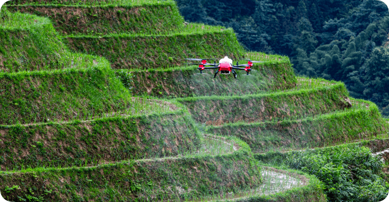
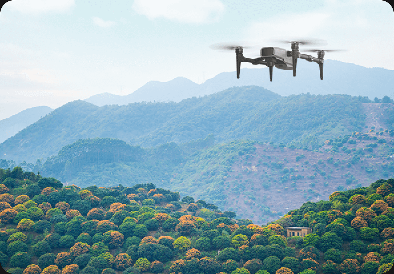
Additionally, drones are valuable for inspecting remote areas or areas with obstacles like hills or trees that may be difficult to reach otherwise.
Drones are increasingly being used in agriculture in the Middle East and North Africa (MENA) region for a variety of purposes. Let’s explore some of the most common uses of drones in agriculture in the MENA region.
Irrigation
Drones have become an invaluable tool for accurate data capture for soil testing, crop counting and irrigation in MENA countries. Here’s why:
- Less than five percent of the land in the region is arable.
- A majority of countries in MENA continue to use groundwater at rates that exceed their renewable internal freshwater resources, making this region one of the most water-stressed regions on earth.
- 85 percent of the region’s water is used by agriculture.
- A rainfall of 400-600mm per year allows for crop cultivation, but irrigation is needed to sustain high yields.
Source: https://www.fao.org/3/i9166e/i9166e_Chapter2.pdf
Using the latest mapping accuracy techniques alongside advances in automation, farmers can precisely assess the land and its requirements with the aid of a drone. More precisely, drones can be used to monitor and control irrigation systems, making it easier for farmers to ensure that their crops receive the right amount of water at the right time.
By using drones, farmers can take better advantage of water resources, allowing them to optimize their irrigation systems with regards to both environmental impact and economic activity.
Crop Monitoring
The use of drones in crop monitoring is revolutionizing the agricultural industry. Through advanced sensors and imaging, they can provide farmers with insightful data to help them increase productivity and yield. Not only can they provide information about soil conditions, plant health and layout, but they can also detect diseases and pests before they become a major issue that may damage crops.
Drones equipped with high-resolution cameras can provide farmers with real-time data on the health and growth of their crops. This information can be used to make informed decisions about irrigation, fertilization, and pest control.
By analyzing the data collected by drones, precision farming techniques can be used to restore balance to fields and optimize production.
Precision Agriculture
Precision farming is an innovative technique for managing crops or livestock on a farm in a more efficient manner. Through the use of technology, such as sensors, GPS systems and software programs, farmers can now make important and specific decisions about crop yield and herd health that they could not previously.
Precision farming provides more accurate information than ever before, allowing farmers to reduce overuse of fertilizers and chemicals while creating better-quality yields. Additionally, this improved accuracy also enables farmers to target only certain diseased plants without wasting resources on healthy plants, increasing overall efficiency.
By eliminating wastage and selecting the most economical and ecologically-friendly solutions for agricultural management, precision farming promises to benefit both the environment and the farmers themselves.
With drone technology firmly established in the sector, the possibilities appear limitless when it comes to analyzing crop growth, allowing farms more opportunities for sustainability.
Farmland Mapping
Drones can be used to create high-resolution maps of fields and farmland. This information can be used to help farmers identify areas that need attention, such as those that may be suffering from soil erosion or have high levels of weed growth.
“Using a drone-enabled aerial mapping system is the ideal solution to generate high-resolution, highly-efficient aerial data, including topographic mapping, contouring, vector mapping and textured 3-D city models,” said Dr Thani Al Zeyoudi, the Minister of Climate Change and Environment, UAE.
By deploying drones equipped with advanced remote sensing technology, farms can quickly get a detailed overview of their property. Thanks to the nearly instant access to real-time mapping of soil health and vegetation, as well as aerial imagery that captures the state of their land in detail, farmers can make optimal decisions on crop production and overall management of the arable land.
Additionally, drones are being used in conjunction with other sophisticated geospatial analysis tools to collect more accurate data while reducing labor costs and operational risks associated with traditional farming methods.
With an estimated 83% of global crop output based on manual labor, drone-assisted mapping provides farmers a reliable alternative for tracking land development quickly and efficiently.
Livestock Monitoring
Drones equipped with thermal cameras can be used to monitor the health and wellbeing of livestock, including identifying sick animals and helping farmers to keep track of their herds.
By deploying autonomous robotic systems, so-called “digital shepherds” with an emphasis on environmental stewardship and animal welfare, farmers are able to identify potential issues quickly and increase their accuracy of livestock care at the same time.
This increased oversight can be applied to many aspects of the farming enterprise, including herd health, nutrition management, pasture management, and water inventorying.
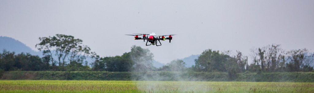
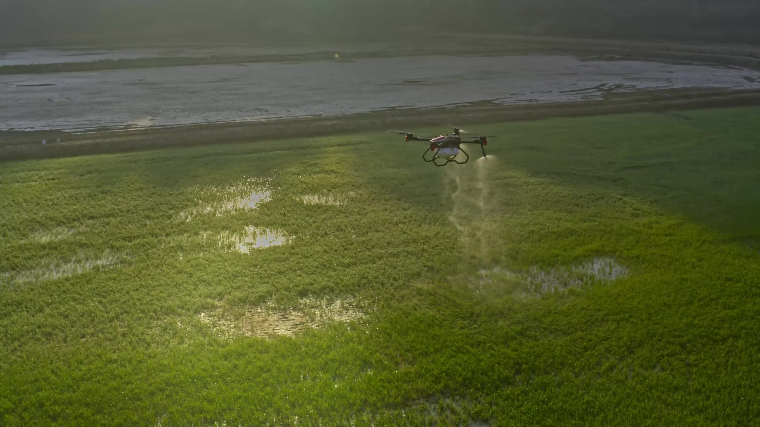
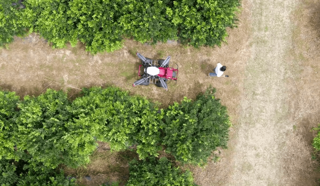
Pesticides Application
With traditional methods, such as ground-based pesticide sprayers, farmers have limited control and accuracy of pesticide application.
UAVs enable farmers to precisely target pesticide applications, which decreases the overall amount used while maintaining its effectiveness. Besides, using drones is much more cost-efficient and environmentally friendly than other traditional methods of pesticide application.
UAVs can deliver more accurate coverage across large fields in a fraction of the time of other ground-based vehicles, greatly increasing labor efficiency and reducing costs associated with pest management and weed control.
With additional developments focused on furthering the capabilities of automated drones within agriculture, it’s clear that this is an exciting area of innovation which will continue to benefit presspective yields in farming.
Final Thoughts: Increasing Efficiency and Sustainability with Drones
The use of drones in agriculture in the MENA region has the potential to significantly improve efficiency, reduce costs, and increase productivity, making it an important tool for farmers in the region. Drones also provide data more quickly than traditional survey methods when coordinating operations over large gardens or fields. In short, leveraging drones provides numerous benefits not only to farmers, but agriculture as a whole by improving farm management practices across global food production systems.